
Frequently Asked Questions (FAQs)
Unionville Special Policy Area Questions
- Remove SPA lands that are no longer within the flood plain
- Review existing SPA lands based on updated flood depth and velocity
- Review lands added to the flood plain and determine whether they should be added to the SPA
- Lands that are no longer within the flood plain.
- Publicly-owned lands that are intended for parks or conservation uses.
- Development and re-development permissions under the current Official Plan and Zoning By-laws.
- Location of the flood plain on the property in relation to buildings, landscaping and setbacks.
- Level of risk related to flood and/or valley erosion hazards.
What is a Special Policy Area?
In Ontario, there are many historic communities that were developed within a flood plain. Current provincial and municipal planning policies restrict development within flood plains which would severely impact the economic and social viability of historic communities in a flood plain.
A Special Policy Area (SPA) is a tool used to recognize historic communities that were developed within a flood plain. It provides site-specific policies to support the continued viability of existing and approved land uses in the flood plain. These site-specific policies provide for certain development permissions that would otherwise be prohibited. Due to the greater flood risks in a Special Policy Area, steps are taken to minimize the risk to life and property when new development is being considered. Uses such as schools, retirement homes and hospitals are prohibited within a Special Policy Area.
The creation or modification of a Special Policy Area require the approval of the Province of Ontario.
Why is the City updating the Unionville Special Policy Area?
In 2019, the Toronto and Region Conservation Authority (TRCA) updated the flood plain boundaries in this area. The flood plain update reflects the latest conditions including topography, land use, bridge/culverts and upstream development. As a result, some lands have been added to the flood plain while other lands have been removed. The City's update will:
Why is the Unionville Special Policy Area necessary?
Portions of the Unionville community is located within the flood plain of the Rouge River and its tributaries. The Unionville Special Policy Area was established in 1990 to recognize historic development within the flood plain. The Special Policy Area provides greater flexibility to existing lands within the flood plain to develop and redevelop. The Unionville Special Policy Area is one policy tool to help support the economic and social viability and vibrancy of Unionville.
How will the new Special Policy Area boundary be determined?
The City and TRCA will review all lands within the flood plain to determine if they should remain or be added to the current Unionville Special Policy Area. Staff will be considering the following criteria when determining the draft SPA boundary:
A draft SPA boundary has not yet been prepared.
What are the policies and boundary of the Unionville Special Policy Area?
The policies of the Unionville Special Policy Area can be found in Section 3.4.1.10 -18 of the Markham Official Plan. The current boundary of the Unionville Special Policy Area is identified on Map 8 of the Markham Official Plan.
Flood plain Questions
- Conducting flood plain mapping and modelling
- Monitoring streams and issuing flood warnings
- Regulating and controlling development in flood plains and other hazardous lands
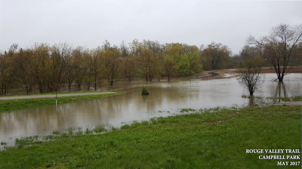
What is a flood plain?
A flood plain is an area adjacent to a river, stream or lake that has been or may be subject to flood hazards.
How is the flood plain boundary determined?
In Markham, the Toronto and Region Conservation Authority (TRCA) is responsible for identifying the flood plain boundaries. The flood plain boundary is determined through a flood plain study which predicts the extent and magnitude of flooding should a storm equivalent to 'Hurricane Hazel' were to occur in the watershed. Hurricane Hazel delivered over 280mm of rain within 48 hours in 1954 which is the greatest recorded amount of precipitation recorded in Ontario.
In 2019, the TRCA updated their flood plain mapping in the Unionville area. Regular updates to flood plain mapping are necessary to reflect changes to the landscape.
I've never seen any flooding in my neighbourhood. Why am I in a flood plain?
Flooding does not occur throughout the entire flood plain on an annual basis. Some areas in the flood plain may experience flooding every year in the spring, while other areas in the flood plain may not have experienced flooding in the past century.
Flood plain boundaries are determined through flood plain studies which are prepared by water resources engineers. Flood plain studies are modeled based on the Regulatory Storm Event which is the worst-recorded storm in Ontario. The Regulatory Storm Event is based on the precipitation received from Hurricane Hazel which dropped 285mm of rainfall within 48 hours in 1954. This storm has less than a 1% chance of occurring annually. Most properties in the Unionville Special Policy Area are within the flood plain associated with the Regulatory Storm Event. Other properties in Unionville are at higher risk of flooding.
The TRCA has prepared a map (click to download) to show the relative risk of flooding in the Unionville area.
Who is responsible for flood plain management?
In Markham, the Toronto and Region Conservation Authority is the lead agency responsible for flood plain management. This includes:
For more information on TRCA's flood plain management program, please visit their website.
Is my property within the flood plain?
The 2019 flood plain map can be found under the 'Documents' tab. This map is provided for information purposes only. For property transactions or legal purposes, a formal letter and confirmation should be requested from the Toronto and Region Conservation Authority (Planning & Development Services).
Preparing for Flood Risks
Does flooding only occur within a flood plain?
Not all flooding are caused by rivers or streams. Urban flooding, such as flooding of streets, basements or other low-lying areas, may occur outside of flood plains. Urban flooding are caused by the overflow of local drainage systems.
A number of factors may contribute towards urban flooding such as improper grading around a building, the design/maintenance of the private drainage system (blocked eavestrough, downspouts, swales), and the design/maintenance of the municipal drainage system (blocked catch basins, sewer back-ups).
Does flooding only occur during the spring time?
Flooding can occur at any time of the year. While flooding is most often associated with the spring time because of snow melt and heavy rainfall, floods can also occur in the summer, fall and winter.
How should I prepare for flooding and emergencies?
Check the Markham Website and the TRCA Website to learn more about emergency preparedness and flood risk.
What do I need to know about flood insurance?
Municipalities are not responsible for flood insurance. Homeowners should consult with their insurance agent for more information.
Building and Development Questions
What if I am within the flood plain but not the Special Policy Area?
Permits from the Toronto and Region Conservation Authority are required prior to any development or site alteration within the flood plain. Homeowners with existing buildings or structures in the flood plain, but not in the Special Policy Area, are subject to the Provincial One Zone Policy approach for flood plain lands. In some circumstances, the One Zone approach may allow for minor additions to the original structure depending upon the level of risk from flooding and erosion, and subject to appropriate flood proofing and design measures.
Homeowners are encouraged to consult with the Toronto and Region Conservation Authority.
What am I permitted to build within the Special Policy Area?
Within the Special Policy Area, you are generally permitted to build within the existing development permissions of the Official Plan or Zoning By-law. This is typically conditional upon addressing a minimum level of flood proofing requirements as identified by the Toronto and Region Conservation Authority. In some circumstances, the size and location of new development may be further limited by erosion or flooding risks.
For low rise residential properties, this generally includes home re-construction, additions, and accessory structures.
For other types of properties (mixed use/commercial), it is recommended that you discuss with City and TRCA staff if there are questions regarding development permissions.
Sensitive uses such as schools, daycare facilities and some institutional uses are not permitted within the Special Policy Area. New lot creation is also prohibited within the Special Policy Area.
What development approvals are required in the flood plain or Special Policy Area?
All development and site alteration within the flood plain or Special Policy Area require approval from the Toronto and Region Conservation Authority. This is in addition to any other approvals that may be required for your development project (e.g., building permit, Committee of Adjustment approvals, Zoning By-law Amendments, Site Plan Approval, etc.).
For any development proposals within the Special Policy Area, the City of Markham should be consulted to determine what approvals or permissions are required.